Trip Report: Akatawara Hill Road Summit to Renata (Attempt)
This post outlines a day trip from the Akatawara Hill Road saddle towards Renata Hut. After a couple of recent winter storms, I ran into a lot of tree fall that slowed things down sufficiently so that I ran into my time limit and turned back, however, it was a struggle to find information about the route, so I’m happy to document what I ran into up to about 3/4 of the way to Renata Hut.
Quick facts:
Start time: 8:30am from Akatawara Hill Rd saddle
Finish time: ~ 2pm
Walking time: 5.5 hours - 3 up, 2.5 down
Topomap: BP32 and BP33, here’s the frame on topomap.co.nz.
This route uses the rarely used Akatawara Hill road entrance to the Tararua Forest Park (NOT the Ngatiawa Road entrance used to access Kapakapanui). The entrance is located directly across the road from the gravel dump spot at the summit of the Akatawara Hill Road. I’ve read of multiple break-ins at this spot, and passing a burnt out car on the way up (that was not there last time I passed!) is evidence enough that while it’s safe enough for day parking, it might not be the spot to leave a vehicle overnight. A pity, as the walk would make a great short overnight (an alternative overnight, albeit with a longer day, would be to park at Ngatiawa and walk over Kapakapanui and down the ridge to Renata).
The route is entirely on 4WD track as far as Maymorn Juction, where the 4WD track continues to Waiotauru Hut. I didn’t get up to the Junction, so my entire experience is on the 4WD. Note that I say “track”, not “road” here - I was impressed that any vehicles can get up at all, but did see some tyre treads in the mud, so assume the track is still used. Because the track is 4WD, it is a relatively gentle gradient, and there is gravel along much of it.
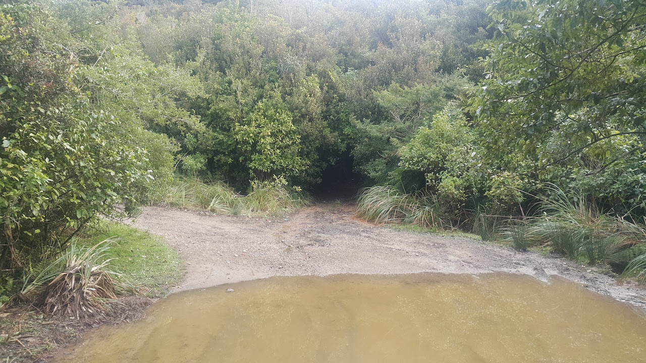
Starting at the saddle carpark, there is a steep rough section for a couple of hundred metres to start - I suspect this has intentionally been dug in to discourage anyone who doesn’t have an adequate vehicle from venturing up (I had optimistically hoped to get my all-wheel drive up the “road” (as it is marked on maps) some of the way to shorten the day, but this is impossible). After this, the track more or less levels, and winds its way up the hillside. I did this in winter, but judging from the size and location of the puddles, in the first 20 minutes of walking, expect to get wet feet. Most have a dry-feet route around them, but overall, your chances of keeping those feet dry are low - you might be better off just wading through.
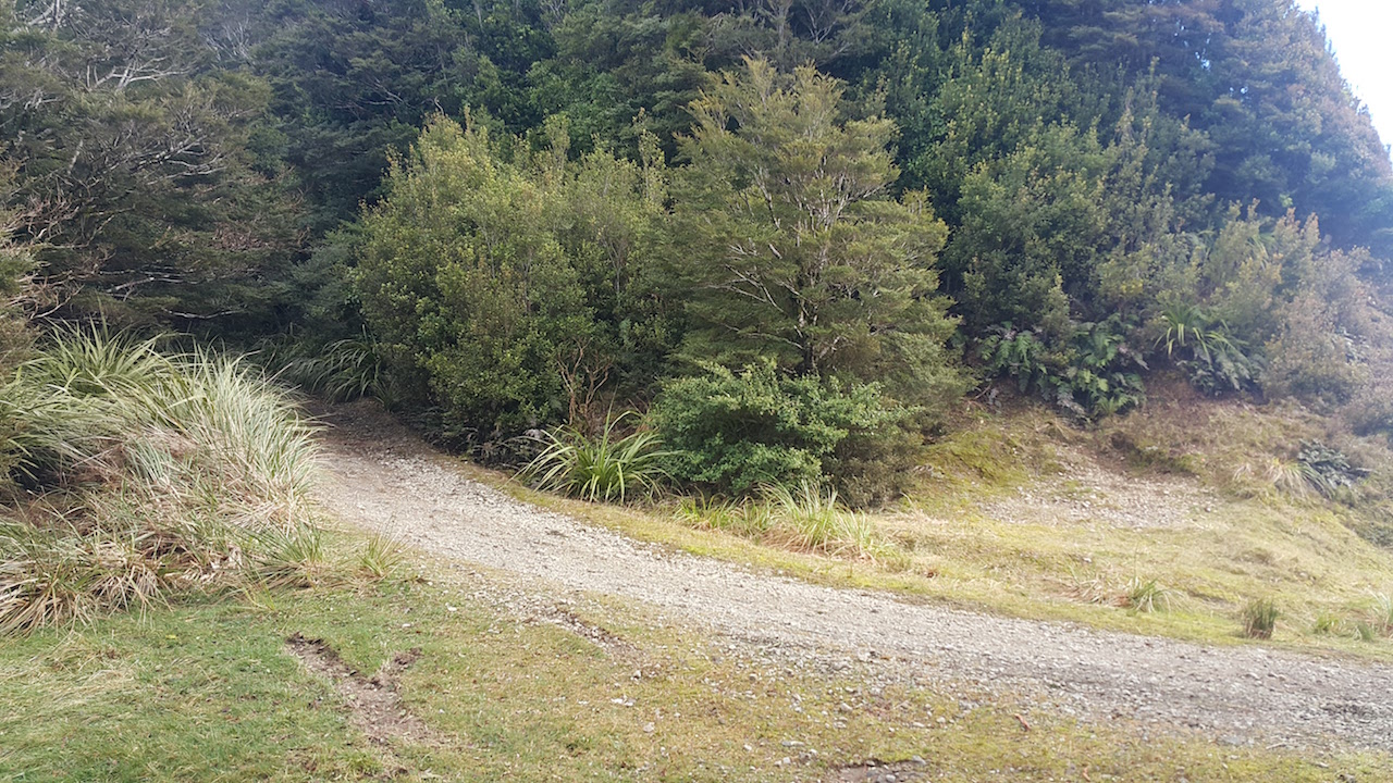
The 4WD track remains roughly the same all the way up. There are occasional rough patches, and it is clay, so parts are slippery, but it’s easy to move pretty quickly. There are a few places where the track forks - I think these have been added by 4WD-ers after some variation in the route and it’s obstacles - I just picked the option that looked the most used and it worked out fine - I think that all of the forks rejoined the main track in any case.
I was checking the topomap on my phone frequently and still managed to miss when the “road” turns into a normal track. For others’ reference, it is where the road goes around a wide bend, with a small patch of grass. While the track remains pretty much the same underfoot, it does close in a bit.
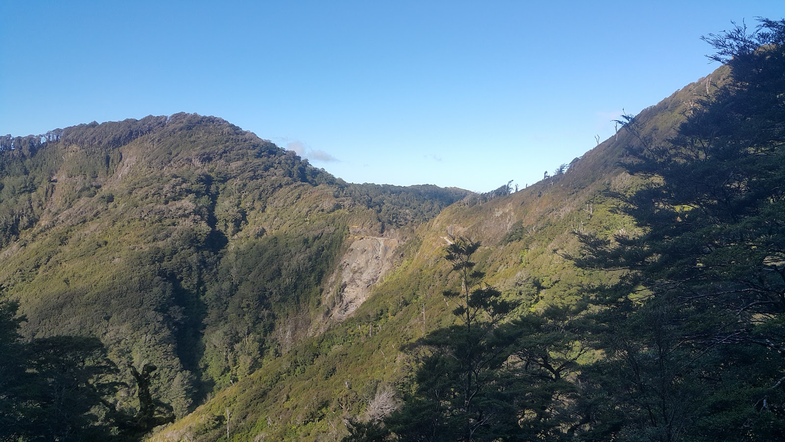
The track continues - on the topomap it is shown as if the track goes directly along the ridgeline. In reality, it actually traverses on the eastern side and about 40-60 meters below the ridge. Along this section is where I encountered a lot of tree fall, all of it looking pretty recent. The entire route is unmarked with tape or triangles, so it’s just a case of sticking to the track and doing frequent map checks.
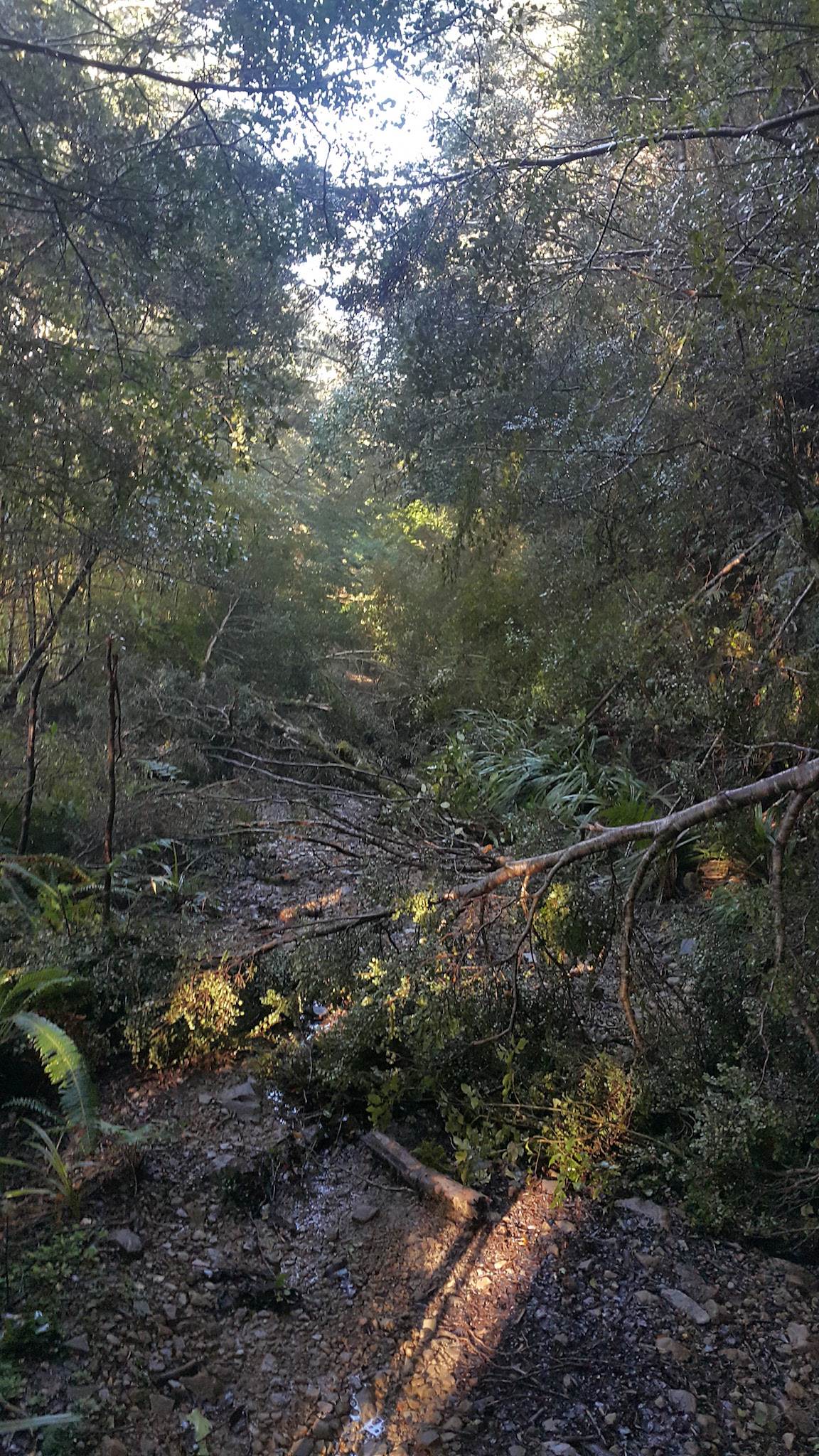
It was all relatively small stuff, but because of this, some parts took a bit of work to fight through, over, or around. There weren’t any trunks thicker than about 20cm, so hopefully a kind 4WD club member or even DOC might make their way up with a chainsaw sometime. When I went up, the treefall was every 50 meters or so. Since I also had a relatively small dog to get through each bit as well, I found that it was taking me 2 or 3 minutes to negotiate each section. Probably without the dog it would be faster, but it’s still tough going.
My turnaround point was a large slip in the saddle immediately before the unnamed high point at an altitude of 762m on topomap BP33. While the DOC time to Renata Hut from the saddle was described as four hours, I had expected to make it up the hill a bit quicker, and couldn’t quite fit a full 8 hour day in. I had set my turnaround time to get to Maymorn Junction at least at 3 hours, knowing it was an additional 30-40 minutes to Renata Hut along the Junction.
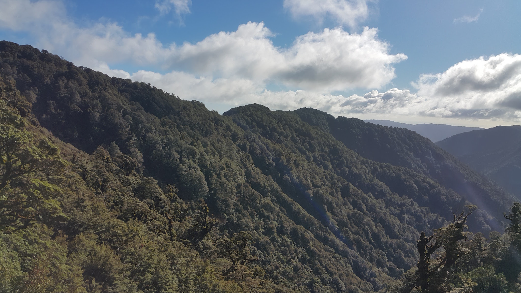
I reached the slip bang on 3 hours. It was about as good a weather as I have ever had in the Tararuas, but I still eyed the cloud hovering around Kapakapanui with a bit of caution, and considered that I had to make my way back through all of the treefall, and made the correct decision to stick to my cutoff time. While it did take me less time to head downhill than uphill, I still spent a decent chunk of time maneuvering through downed trees, reaching the road again after about 2.5 hours. I estimate that it would have taken me at least an additional half an hour to reach Maymorn Junction, where the track from Kapakapanui meets this track, and the 4WD track drops off, and at least a half hour beyond that to reach the Hut.
This trip was another great reconnaissance for future adventures. If there was slightly less dodgy looking car parking, this trip would be a great short overnight and I suspect would be a lot more popular. With the treefall, I’m not sure it’s a great day walk right now, as fighting through fall after fall becomes tiring quite quickly, especially when contemplating the return journey that same day - however, the forest is classic Tararuas, and the track is well graded and in good condition (aside from the trees!).