Trip Report: East Holdsworth Loop
This trip report covers a fantastic day loop that I found to be a little under-documented when researching - especially the East Holdsworth track, which has become one of my favourite Tararua tracks.
Started: 9:15am from Holdsworth Carpark
Finished: 4:50pm at Holdsworth Carpark
Times:
- 1hr up Atiwhakatu Track
- 2.75hrs up East Holdsworth Track
- 20min to Mount Holdsworth Summit
- 30min from Summit to Powell Hut
- 2hrs from Powell Hut to Holdsworth Carpark
We made a prompt, but not too early start from Wellington, heading over the Remutaka Hill Road and straight to Holdsworth - not even a coffee stop. We arrived at the carpark, which was significantly less busy than we had expected given the weather forecast, which was for “Fine, Light Winds” - the Tararua Unicorn weather.
We had organised our daypacks, lunches and snacks the night before, so we were able to get away about quarter past 9, stopping briefly at Holdsworth Lodge to fill in our intentions. We crossed the Atiwhakatu Stream and headed up towards the main intersection at the start of the Gentle Annie track, taking our usual 10-15 minutes along the flat, wide track to get warmed up. We carried on straight at the intersection, continuing through Donnelly Flat and up the Atiwhakatu Valley.
The Atiwhakatu Track is popular with dog walkers and mountain runners as well as trampers, and we met several people going both ways along this track. The track is well graded and maintained, and we were able to stick to our normal pace for this track to meet the swingbridge back over the Atiwhakatu Stream after one hour. A brief wobble over the bridge with the dog (who can’t walk across due to the mesh and needs to be carried), and we reached the intersection with the East Holdsworth Track 2 minutes after the swingbridge.
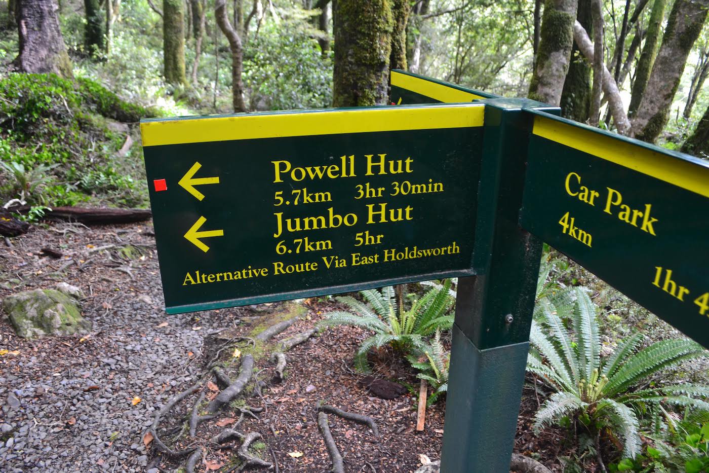
The East Holdsworth track is one we’ve passed several times on our way up or down the valley. We had been looking for a good weather window to do a loop up this track and back down Holdsworth for some time, as we were interested to see what kind of climb needs to be done to reach the Holdsworth-Jumbo ridgeline in just a few hours.
The East Holdsworth track [topomap] starts off surprisingly, suspiciously easy, travelling along flat terraces with short sharp climbs between each level for about 45 minutes. Towards the end of this time, there is less and less flat terrace, and more and more uphill, as the track steepens to climb up towards the bushline. This section takes some time - around 45 minutes to an hour, as it climbs most steeply between 650m and 1000m. After this, there is a slightly less steep section for around 30 minutes before reaching the bushline at 1200m.
We found that some careful monitoring of rest stops and breaks was needed - despite the relatively brief time period the main climb covers, hourly rest stops weren’t sufficient, and we made an early stop for lunch beneath the bushline at around 1100m. Next time we do this track, I would be inclined to break the uphill climb into shorter sections, as I think we probably allowed ourselves to use up more energy in the steepest part of the climb, which made things harder for us nearer to the bushline.
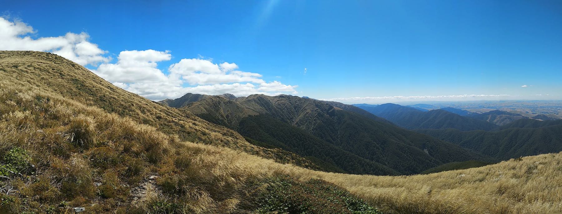
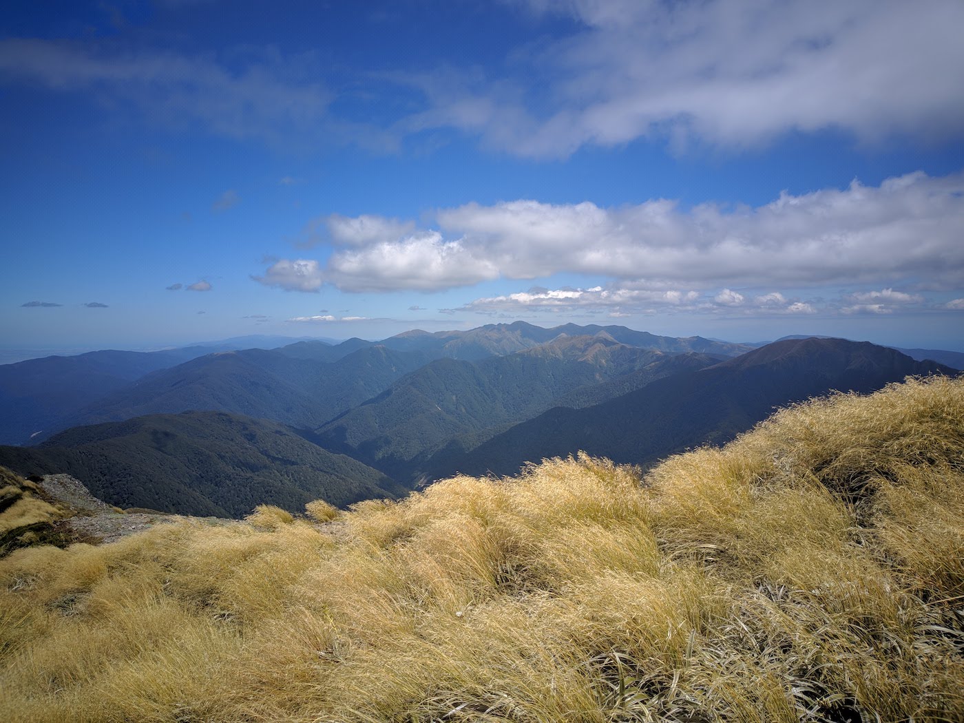
On a clear day, at the bushline you will be rewarded with sweeping views over the Wairarapa Plains, along with views looking North towards Jumbo and Mitre. We found the remaining climb up through the Tussock to the main Holdsworth-Jumbo ridgeline a lot easier, with a northwester coming down off the ridge to cool us off and a better and better view of Holdsworth and Jumbo the further up we got. In fact, with the wind being a little stronger than forecast, we stopped at a rocky platform around 1250m to put on thermal tops, just to keep the wind off.
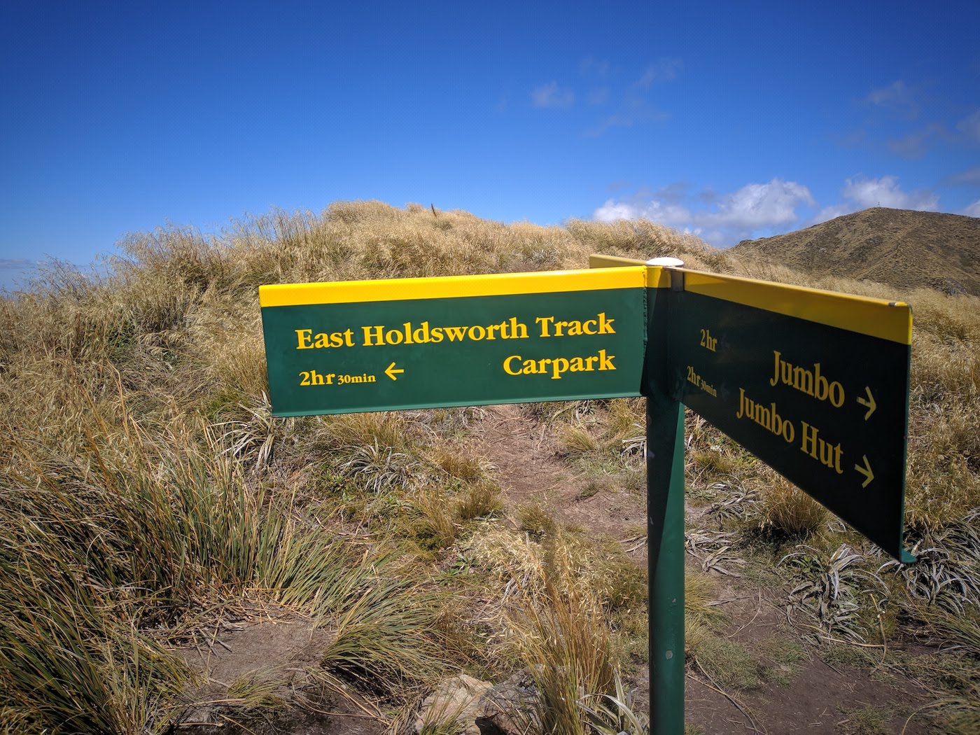
From the bushline to the ridge took us around 30 minutes, with more of a terraced climb up to the Holdsworth-Jumbo circuit - gentle slopes followed by short/sharp climbs up the rocky tussock-covered ridge. There’s a DoC sign at the intersection showing the way to Holdsworth/Powell, Jumbo, and back the way you came. It’s worth keeping in mind the possibility of using this track as an emergency exit from the main circuit, as the sign at the intersection indicates that the return trip to the carpark takes just 2.5 hours (personally I would expect that to take longer to get down the steep track, but perhaps that time is intended to be a little lower than it actually is to persuade people who are on the fence to follow the quickest route off the exposed ridge).
Once the main track is reached, the going becomes easier - both due to being on top of the hill, and because there is less tussock cover at the top, with most of the walking being along rock and gravel. There are a couple of small knobs to sidle around along the ridge before the final climb up to the trig at the top of Holdsworth. We found we made good progress in this section, reaching the trig 20 minutes after leaving the East Holdsworth intersection.
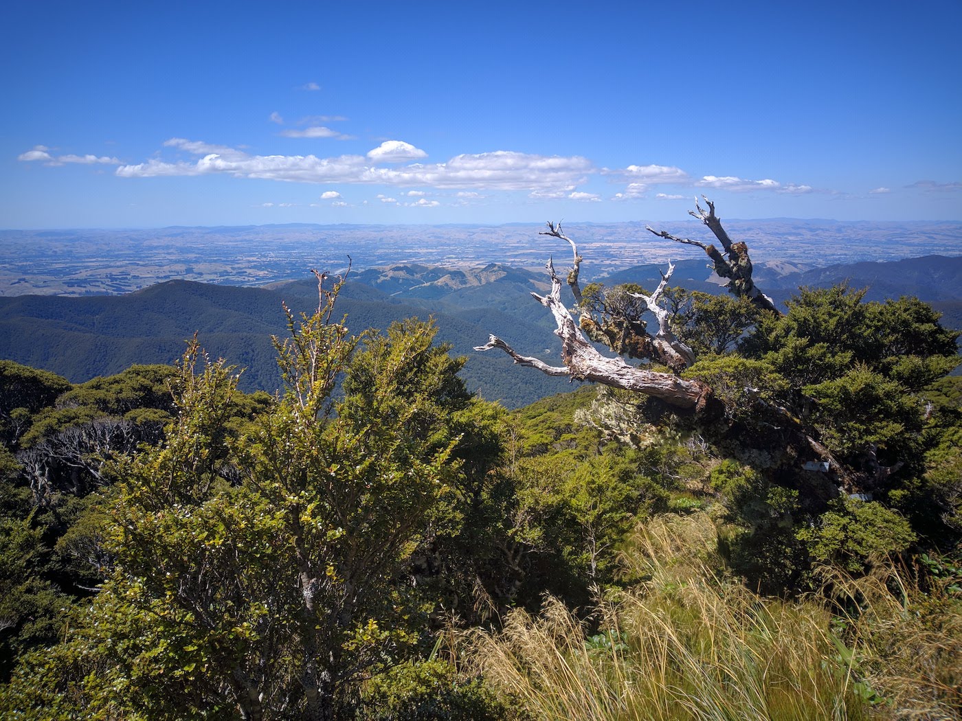
We stopped for 10 minutes or so at the trig for a quick peek around with the binoculars, spotting the aircraft wreckage of an RNZAF De Havilland Devon that crashed in 1955, and was controversially stolen in 2009 and returned in 2010. This was definitely the clearest day we’ve had at the summit of Holdsworth, and we could see right out to Kapiti Island to the West, the Wairarapa Coastline to the East, and Hector, Maungahuka, Aokaparangi and Kahiwiroa along the main range beside us. Directly ahead was Jumbo, Angle Knob and Shingle Slip Knob, with McGregor and the Broken Axe Pinnacles in the background. Fantastic views.
From Holdsworth, we followed the ridgeline south towards the construction site at Powell Hut. The rebuild of this hut is expected to completed at the end of April 2019, and it looks like they are making good progress on the main building, with roofing going on and a larger deck under construction. While the construction is ongoing, there is NO shelter or access to the hut, and also NO water supply or toilets available to trampers.
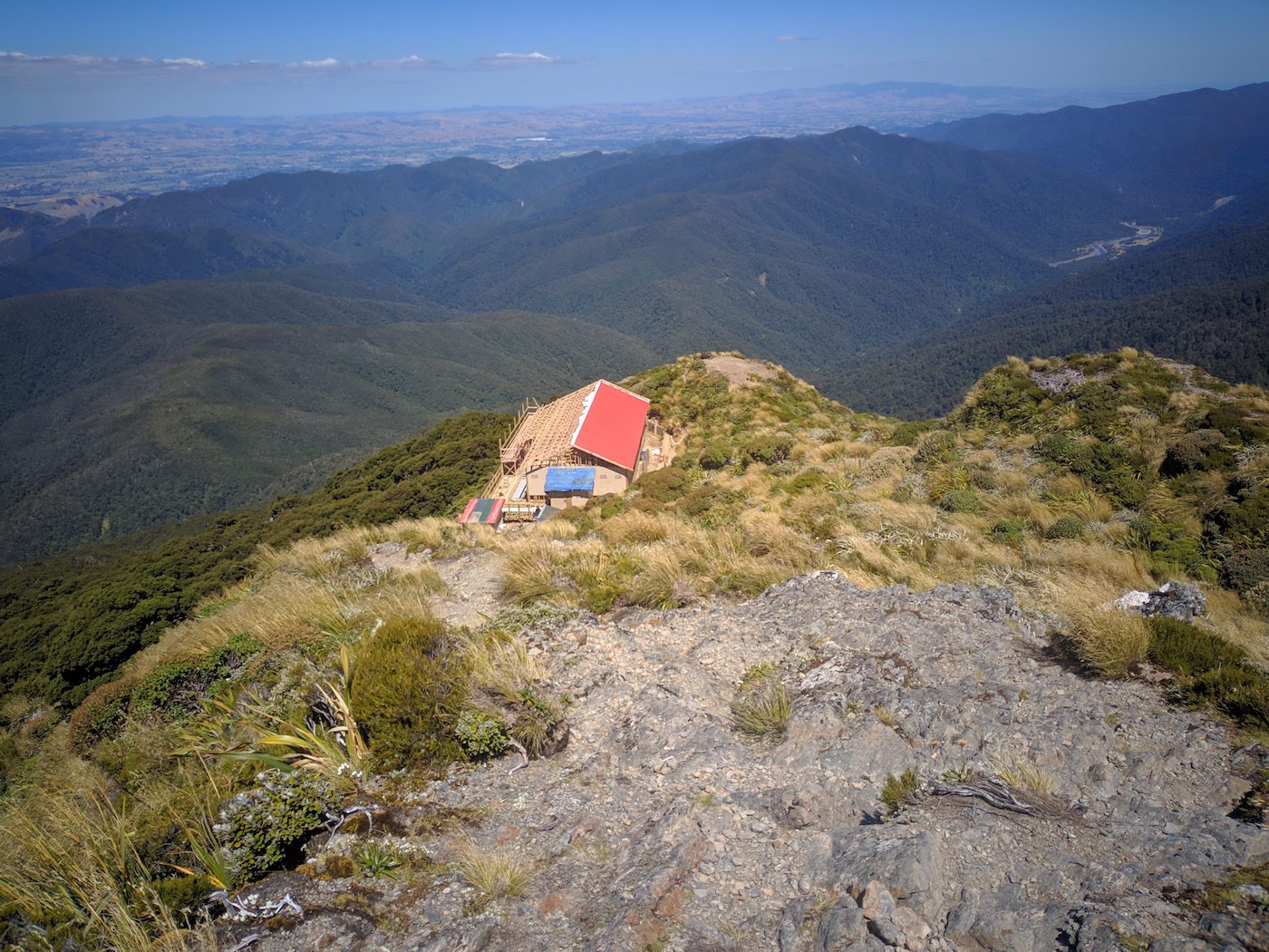
There is a rough diversion “track” in place that bypasses the construction site. This “track” is temporary, and as such as fairly rooty and rough. There’s mud underfoot which makes for a bit of a slip and slide, with the diversion taking around 10 minutes and emerging about 10 meters below the altitude of the hut at the base of the final set of stairs. We heard a number of helicopters (or maybe the same helicopter multiple times?) through the day in the direction of Powell, so suspect they were also making the most of the nice weather.
From here, we were following the Gentle Annie track that we’ve done several times before, and by this point were mostly on autopilot and feeling pretty tired. We had a short break at Mountain House to remove a layer (thermals) that were no longer needed, and refill our waterbottles that we had been rationing since Mt Holdsworth. After Mountain House, it was a quick scramble back down the track, reaching the main intersection with the Atiwhakatu Track around 4:30pm, and arriving back at the car at 4:50pm.
Overall, this loop did take a little longer than expected, but for a day trip that covers the range of forest and terrain this particular loop does, I believe it’ unparalleled, in the Tararua Forest Park at least. A large contributor to the variety on display on this loop is the East Holdsworth Track. While we found it steep, it had a great variety of terrain, views and ecosystems on the climb from river level to the tops. We were even fortunate enough to see a Kaka flying overhead and hear another, most likely due to the extensive trapping program going on around Donnely Flat. This track has definitely gone onto our favourites list, and can only assume that we struggled to find detailed trip reports covering this track previously due to the authors’ wish to keep it quiet for themselves!