Mitre Flats: Tararua Forest Park
This trip was a bit opportunistic, making the most of a fine weekend in late winter to start getting back into the Forest Park before the official start of the summer season!
Mitre Flats is one of the more popular spots to visit from the Wairarapa side of the Tararua range, and has been on our to-do list for some time. Mitre Flats is a good location to start from if heading towards one of the nearby high points:
There’s also a tricky-looking loop track to do that could be done in a long weekend, heading into Mitre, up and across the Broken Axe pinnacles (a narrow rocky ridge from the looks of it), and down to Jumbo Hut, returning up the Atiwhakatu valley back to Mitre. Something for another day!
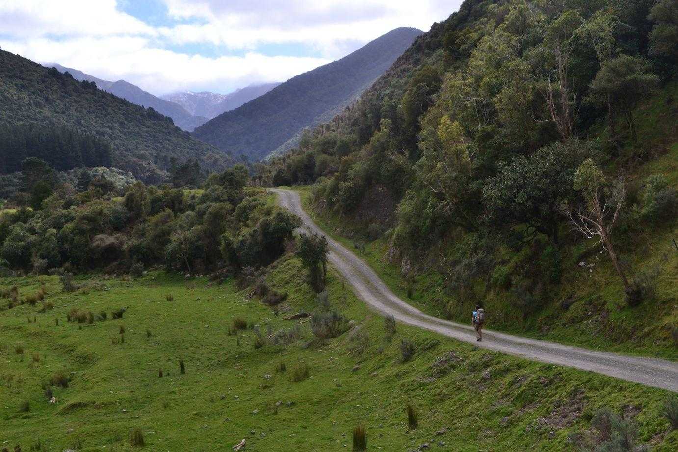
The track to Mitre is known by some sources as the Barra Track, or just the Mitre Flats track. It’s reached about 15 minutes from Masterton, past the Mt Holdsworth turn off and after skirting around the outside of Masterton on the ring road that follows along the train tracks. The rural road turns to gravel a few kms before the track start. The road seems to terminate around the start of the track, near a fenced-off bridge over the Waingawa River. At the track start, there is a lay-by on both sides of the road for parking, and a small shelter. No toilets or fresh water supplies here, so you’ll be pretty quick to set off through the pedestrian gate next to the cattle grid and along the farm road.
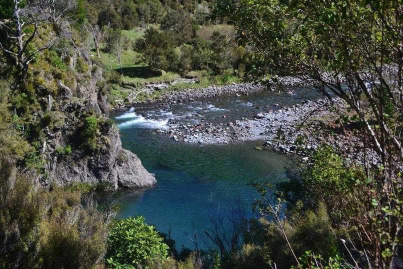
A slightly different approach to the hills than we’re used to around Wellington, you’ll be continuing along this farm road for the first 30-45 minutes before the park boundary is reached. It’s not a particularly dull walk though, as the track follows alongside the river, which looks like it has some great swimming holes. After a short time, you’ll reach the entrance to one of the farm houses, where the track turns 90 degrees to head along the property boundary, before crossing farm road beside a shearing shed and dropping off the terrace to cross a swampy bit and a small bridge across a creek before arriving next to the river. About 10-15 minutes after this point the bush edge is reached, with a short and steep climb back up to terrace level where there is a boundary fence with a stile, and a pretty old and rotten looking sign noting that you’ve just entered the Tararua Forest Park.
From here on in, the track follows a pretty similar pattern until the swingbridge across the Waingawa River is reached a couple of minutes before the hut. The track initially climbs until a point approximately 100m above the river is reached. The track continues along this contour for the next couple of hours - don’t make the mistake I made of assuming it’ll be cruisy though - there is plenty of undulation going on, with a few rocky scrambles. The track is mostly well marked, except for a couple of points around the halfway point where some small rock slips have concealed the original track route. You won’t get lost here, but after going through some knee-high grass, the track will appear to drop off a couple of metres to the left where you’ll then get to a slippy slope to scramble up. Instead of going to the left here, go to the less-obvious right hand route which will save this scramble.
You’ll know that you’ve almost reached the swingbridge when the track begins descending - in traditional Tararua fashion, this is straight down the hill to river level. The bridge is planked rather than aluminum struts or mesh, so it’s quick and easy to cross. On the far side of the bridge is the intersection with the track to the Atiwhakatu Valley, with the turn off to the track to the summit of Mitre just after this intersection. The hut sits in a really nice clearing less than 5 minutes after the bridge.

On this particular trip, we had chosen to camp (since we had the dog with us). I’d say it’s one of the nicest, if not the nicest spots we’ve been to with this. The clearing was large enough for us to comfortably share with a high school outdoor ed group of about 20 students, most of whom were also camping. There’s some nice flat areas past the hut and just inside the bushline on the track to Cow Creek. The hut itself is well maintained, I believe by the Masterton Tramping Club, and sleeps 20. There is a supply of rainwater from the roof and a nice verandah area to enjoy the last of the sun before it disappears (quite early, since the hut is deep in the valley!). Since we were just in for the right, I had treated myself to carrying in an air couch to relax on and catch up on some reading. A perfect spot, however it did get below zero overnight - cold enough to freeze water we had outside the tent.
Returning is much the same, however due to the undulation, the track does feel quite different going the other way. The climb up from the swingbridge is mercifully brief, and after that it’s just a matter of knocking off the distance until the farmland is reached. Meandering back along the farm road in the sun was a nice way to wrap up the trip, while looking at the tempting pools in the river below.
This was very much a recon trip for us, as we’ve had our eye on Mid King Biv, Broken Axe Pinnacles, and the Cow Creek area for a while. I think we were probably hoping for a slightly easier trip than we ended up with, but the great campsite more than made up for the slightly tougher walk!
The DOC time for this track is described as 4 hours. It took us 3.5 moving quite slowly with lots of breathers, but I think that because of the track surface and terrain that time is probably what most people could expect to do it in. For more information on hut facilities and up to date alerts, see the Mitre Flats Hut page on the DoC website.